Story
The story of Mount Dajti
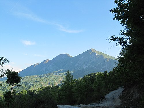
Look east from Tirana and the long ridge filling the horizon is Mount Dajti, part of the Skanderbeg Mountains. It stretches 8 km in length and 5 km in width, and its highest peak, Maja e Dajtit, reaches 1,613 metres. The mountain is made mostly of limestone, with notable karst formations.
Its eastern slope is steep, while the western slope descends gradually onto the plain of Tirana, marked by an ancient marine terrace called Fusha e Dajtit. As you climb the western side you pass through three belts of vegetation: Mediterranean shrubs such as strawberry tree, juniper and heather low down, then oak forest, and finally beech and conifers above 1400 metres. The summit itself is bare and serves as the base for the central antenna of RTSH.
Up here the climate is cool, averaging 12 °C at around 1,000 metres, and a good share of the precipitation falls as snow. The mountain and its surroundings are protected as a national park.
This story is compiled from Wikipedia and other open sources; dates and numbers are checked against the source. The text is shared under the CC BY-SA 4.0 licence. Source ↗
Hear this story on the spot, in a natural voice
On Sightlore, the story of Mount Dajti is narrated in a natural voice in 5 languages. When you arrive, say "I'm here" and get your passport stamp.
28 more stories from Tirana in the app
More highlights in Tirana
- Bunk’Art 2A 1,000 m² bunker with 40 rooms near the Ministry of Internal Affairs in Tirana, presenting history from 1912 to 1991 through State Archive and ministry records.
- Bunk’ArtA five-storey underground bunker in the Shish Tufina area of Tirana, built between 1972 and 1978; it displays objects once used by Albania's communist leaders.
- National Historical MuseumThe National History Museum is a historical museum in Tirana, Albania. It was opened on 28 October 1981 and is 27,000 square metres in size, while 18,000 square metres are available for expositions.
- Pellumbas CaveThe Cave of Pëllumbas is a karst cave in central Albania, located in the Skorana Gorge close to the village of Pëllumbas in Tirana County.
- Pyramid of TiranaThe Pyramid of Tirana is a structure and former museum located in Tirana, the capital of Albania. It opened as a museum in 1988 and became a conference center in 1991 following the collapse of Communism.
- Petrelë FortressPetrelë Castle is a castle in Petrelë, central Albania. Its history dates back to the 6th century, when it was built by the Byzantine emperor Justinian I. Petrelë Castle is 329 metres (1,079 ft) above sea level.